

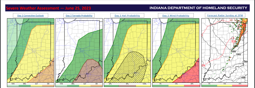
Overview: The Storm Prediction Center has placed the majority of Indiana under a Slight Risk (2/5) for severe weather for Sunday June 25, and far western and northwest Indiana under a Marginal Risk (1/5). This threat looks to come in 2 different waves. Damaging winds are the main threat with the first wave of storms in the overnight to early morning around 4-10am. Clearing and daytime heating Sunday will give fuel to initiate storms in a second wave in the afternoon to evening period beginning roughly around 2-3 pm. This should also support the possibility of supercells that could form likely early in the event as the day progresses with more of a severe multi-cell line increasing in potential later in the evening. There is still some uncertainty as to the exact track and timing of this event as well as how the first wave will impact the environment. All severe weather threats are on the table with these storms, but primarily, large hail and damaging winds. Storms will look to organize after development and head south and eastward as they make their way out of the state and into Ohio and Kentucky. All images have been updated with the latest forecast information.
Stay alert tomorrow and keep an eye on social media, EMFT will keep you up to date if severe weather threatens our community.